The Wild Atlantic Way is Ireland’s signposted coastal touring route, launched by Fáilte Ireland in 2014. It runs about 2,500km (roughly 1,550 miles) from the Inishowen Peninsula in Co. Donegal to Kinsale in Co. Cork, through nine counties. By my estimate, driving all of it takes 50 to 60 hours at the wheel. Allow two weeks for the whole route, or pick one or two regions.
The west coast of Ireland doesn’t do straight lines. It folds in and out of bays, peninsulas and fjords for the length of the country. The Wild Atlantic Way is the official road route that follows nearly every fold.
That’s the joy of it, and the catch. You can’t see it all in a week, though plenty of people try.
This guide runs down the coast north to south, from the lighthouses of Donegal to the cliffs of West Cork. Then come itineraries for 7, 10 and 14 days, driving tips for first-timers on the left, and when to go.
Jump to:
- What is the Wild Atlantic Way?
- Wild Atlantic Way map: the route at a glance
- The Wild Atlantic Way route and best stops, north to south
- How long does it take to drive?
- Itineraries: 7, 10 and 14 days
- Driving tips
- Best time to go
- Getting there: the nearest airports
- 5 things every trip should include
- Wild Atlantic Way FAQ
- Further reading and photo credits
- More Irish travel reading
What is the Wild Atlantic Way?
It’s a touring route created by Fáilte Ireland, the Irish tourism development authority. Michael Ring, then Minister of State for Tourism, officially launched it on 27 February 2014.
It isn’t one new road but a chain of existing ones, signposted as a single route. Tourism Ireland calls it the world’s longest defined coastal touring route. Note the word “defined”: nobody official claims it’s the longest coastal road on Earth.
How long is the Wild Atlantic Way in km and miles?
The official figure from Discover Ireland, Fáilte Ireland’s site for visitors, is 2,500km (about 1,550 miles). You’ll also see 2,600km, 1,500 miles and 1,600 miles online, but 2,500km is what the people who drew the route say.
For contrast, the fastest inland roads from Malin Head to Kinsale cover only about 520km (323 miles). The coast adds roughly 2,000km (about 1,240 miles) of wiggles.
Where does the Wild Atlantic Way start and end?
Officially it runs “from the Inishowen Peninsula in Donegal to Kinsale in Cork”. Some 2014 coverage named the village of Muff, on Inishowen, as the northern end. Many guides start it at Malin Head, Ireland’s most northerly point.
There’s no official start line. The route is signed both ways, so drive it whichever way suits your flights. This guide runs north to south, the same way as my reel.
Which counties does it pass through?
Nine coastal counties, north to south: Donegal, Leitrim, Sligo, Mayo, Galway, Clare, Limerick, Kerry and Cork. Two are easy to miss. Leitrim’s coast is under 5km (about 3 miles) long, at Tullaghan. Limerick’s share is the south shore of the Shannon Estuary, which you skip if you take the Killimer ferry.
Wild Atlantic Way Discovery Points and the 15 Signature Points
Along the route are Discovery Points: viewpoints, beaches, piers and headlands, each with its own signpost. The count has changed over time: 159 at launch, 188 in Tourism Ireland’s 2024 figures, and 180 on Discover Ireland today. “About 180” is the safe answer.
Fifteen are Signature Discovery Points, the headline stops, listed in the table below. Four of them appear in my reel: Fanad Head, Killary Harbour, the Cliffs of Moher and Mizen Head.
What do the signs look like?
Look for brown road signs with a blue and white zig-zag “WAW” logo, like a line of waves. RTÉ reported plans for almost 4,000 of them in 2014. A letter in brackets, (N) or (S), tells you whether you’re on the northbound or southbound route, which matters at junctions.
Wild Atlantic Way map: the route at a glance
Here’s the whole coast in one table, north to south.
| County | Signature Discovery Points | Stops in this guide |
|---|---|---|
| Donegal | Malin Head, Fanad Head, Sliabh Liag | Malin Head, Fanad Head lighthouse, Teelin and Sliabh Liag |
| Leitrim | None | The short coast at Tullaghan |
| Sligo | Mullaghmore Head | Mullaghmore Head |
| Mayo | Downpatrick Head, Keem Bay (Achill) | Downpatrick Head, Achill, Croagh Patrick, Carrownisky Strand |
| Galway | Killary Harbour, Derrigimlagh | Killary Harbour, Glassilaun, Lough Inagh, Derrigimlagh, Kinvara |
| Clare | Cliffs of Moher, Loop Head | The Burren, Cliffs of Moher, Loop Head, the Killimer ferry |
| Limerick | None | The Shannon Estuary shore |
| Kerry | Blasket Islands (Blasket Centre), Skellig Islands | Slea Head and Dunmore Head, Ring of Kerry, Valentia Island |
| Cork | Dursey Island, Mizen Head, Old Head of Kinsale | Healy Pass, Dursey Island, Mizen Head, Kinsale |
For a proper map, Discover Ireland has a free interactive Wild Atlantic Way map with the Discovery Points marked.
If you want the whole coast in about a minute, from Fanad Head to Mizen Head, watch this:
The reel is made from licensed drone footage, set to my own song, “Wherever We Roam”. Every stop in it appears below, in the same order.
The Wild Atlantic Way route and best stops, north to south
Irish country roads are slower than any app thinks, so add time to every leg.
Malin Head, Co. Donegal
The route begins on the Inishowen Peninsula, by the border with Northern Ireland. Malin Head is Ireland’s most northerly point and a Signature Discovery Point. At Banba’s Crown, the tip, stands a watchtower from 1805. When the Northern Lights are forecast, you may catch them here.
Fanad Head lighthouse, Co. Donegal
Fanad Head is the first stop in the reel and another Signature Point. The lighthouse stands between Lough Swilly and Mulroy Bay. It was built after the frigate HMS Saldanha was wrecked in Lough Swilly, with the ship’s parrot said to be the only survivor. It was first lit on St Patrick’s Day, 17 March 1817.
Fanad Lighthouse Experience runs guided tours, best booked online, and rents out the old keepers’ cottages. Check times at fanadlighthouse.com. From Malin Head it’s about 127km (79 miles) by road.
Teelin Bay and Sliabh Liag, Co. Donegal
Teelin (Teileann) is a small village and pier below the cliffs of Sliabh Liag. It’s in the Gaeltacht, an area where Irish is still spoken as a community language.
Sliabh Liag (say “sleeve leeg”) is a Signature Point. The cliffs rise to about 600m, nearly 2,000ft. Discover Ireland calls them the highest accessible sea cliffs in Europe, and suggests a boat trip from Teelin to see them from below.
On land, park free at the Visitor Centre on the Bunglas Road in Teelin, 4km (2.5 miles) from the cliffs. From July to September a shuttle bus runs from there. The Ranger Station car park, 2km (1.2 miles) from the cliffs, charges a fee.
Off-peak, you can drive up to the viewing area car park with a ticket bought at the Ranger Station. Check sliabhliag.com before you go. From Fanad it’s about 125km (78 miles).
Mullaghmore Head, Co. Sligo
Heading south, you pass Leitrim’s tiny coastline at Tullaghan before the radio finishes a song. Then comes Mullaghmore Head, Sligo’s Signature Point. Discover Ireland says expert surfers ride huge winter waves off here. Everyone else should watch from dry land.
Downpatrick Head and Achill, Co. Mayo
Mayo has two Signature Points. Downpatrick Head has the ruins of St Patrick’s Church high on its cliffs. Keem Bay is at the far end of Achill, which you reach by bridge. Discover Ireland calls Achill Ireland’s largest island.
Killary Harbour, Galway and Mayo border
Killary Harbour is the next stop in the reel and a Signature Point. Discover Ireland calls it one of only three glacial fjords in Ireland, forming a natural border between Galway and Mayo. You’ll read “Ireland’s only fjord” elsewhere, but the official line is one of three.
Leenaun (also spelt Leenane) sits at the head of the fjord, about 32km (20 miles) from Westport. Killary Fjord Boat Tours run 90-minute cruises from Nancy’s Point, 2km (just over a mile) west of the village. Discover Ireland also suggests a 16km (10 mile) walk along the harbour, under Mweelrea, Connacht’s highest mountain.
Glassilaun Beach, Connemara
Connemara is the wild western corner of Co. Galway, all bog, lakes and mountains. Glassilaun is a crescent of white sand between Renvyle and the mouth of Killary, with mountains behind it. Galway Tourism says you reach it through the dunes from a small car park, so arrive early on a good day.
A small island at the western end is cut off when the tide comes in. Lifeguard cover isn’t guaranteed, so check tides and conditions first. It’s about 16km (10 miles) from Leenaun, roughly 30 minutes on narrow roads.
Lough Inagh, Connemara
Lough Inagh is a short inland detour off the coast, and well worth it. The lake lies in the Inagh Valley along the R344, with the Twelve Bens on one side and the Maumturks on the other. A lough, by the way, is simply our word for a lake.
Enjoy it from the road and the lay-bys, because the lodge and fishery on the shore are private businesses. For more like it, see my list of the most beautiful lakes in Ireland.
Derrigimlagh, near Clifden
South of Clifden, Derrigimlagh bog is a Signature Point. Alcock and Brown crash-landed here in 1919 after the first transatlantic flight. The remains of Marconi’s transatlantic radio station are here too.
Dunguaire Castle, Kinvara, Co. Galway
Dunguaire is a 16th-century tower house on a rock at the edge of Galway Bay, by Kinvara village. Its official site dates it to 1520. The writer Oliver St John Gogarty bought it in 1924. Kinvara is about 30km (19 miles) from Galway city.
It’s closed, though. The Irish Times reported in September 2026 that it has been shut since 2023 over an ownership and funding dispute. There are no tours or banquets. It still makes a fine picture from the village and the public shore road.
The Burren, Co. Clare
The Burren takes its name from the Irish boíreann, “rocky place”. The National Parks and Wildlife Service calls its grey limestone pavement part of Europe’s largest karst landscape.
Burren National Park covers 1,800 hectares (about 4,450 acres), and 23 of Ireland’s 27 orchid species grow there. Much of the rest of the Burren is private farmland, so stick to the park’s waymarked trails near Gortlecka.
The Cliffs of Moher, Co. Clare
The most famous stop on the route is a Signature Point. The official site says the cliffs reach 214m (702ft) just north of O’Brien’s Tower. They’ve had their moment on screen too, as my piece on the Cliffs of Moher in Harry Potter explains.
Clare County Council runs the Cliffs of Moher Experience, and the ticket includes parking for the day. Hours change through the year, so check and book at cliffsofmoher.ie.
In August 2026 the official site said the coastal walk from Liscannor was fully closed over safety concerns, and the path from Doolin stops at Surfers Path. Inside the site you can still walk about 800m (half a mile) north past O’Brien’s Tower. Stay behind the barriers.
Loop Head and the Shannon Ferry
Loop Head is Clare’s second Signature Point, and Discover Ireland says a lighthouse has guided ships there since 1670. To reach Kerry, most people take the Shannon Ferry from Killimer, Co. Clare to Tarbert, Co. Kerry. The crossing takes about 20 minutes, and sailings change with the season, so check shannonferries.com.
Skip the ferry and you drive the Limerick stretch along the Shannon Estuary instead. The Cliffs of Moher to Dingle is about 227km (141 miles) all by road.
Slea Head and Dunmore Head, Co. Kerry
From Dingle town, the Slea Head Drive loops around the tip of the peninsula. The Dingle Peninsula Tourism Alliance asks visitors to treat it as one-way, clockwise through Ventry. Only residents drive it both ways. Part of the cliff road is single lane, so turn off the sat nav, follow the signs and allow at least half a day.
Out at the end is Dunmore Head, the most westerly point of mainland Ireland. People often give that title to Slea Head, but it’s Dunmore. Enjoy it from the Slea Head road, the Coumeenoole viewpoint or Dunquin, and only walk where signs show public access.
From here you look out at the Blasket Islands, another Signature Point. The Blasket Centre in Dunquin tells their story, and so does my piece on why Great Blasket Island was evacuated.
The Ring of Kerry, Valentia and the Skelligs
The Ring of Kerry loop is about 179km (111 miles), a full day on its own. The reel also shows a mountain road and a jaunting car, a traditional horse-drawn cart for visitors, somewhere in Kerry.
Valentia Island is joined to the mainland by a bridge at Portmagee. The Skellig Islands are a Signature Point. The OPW (Office of Public Works) ended the 2026 landing season early, on 21 September, because of the weather.
Landings on Skellig Michael resume in 2027, normally from mid-May to the end of September, weather permitting. Expect 618 steep steps.
Healy Pass, Cork and Kerry border
Beara is the quieter peninsula south of Kenmare. The Healy Pass (R574) crosses it between two of the highest summits of the Caha Mountains. Discover Ireland describes “12 km worth of hairpin bends” (about 7.5 miles) between Adrigole Bridge in Cork and Lauragh Bridge in Kerry. The road tops out at about 334m (1,100ft).
It began as a Famine relief road in 1847 and was later named after Tim Healy, first Governor-General of the Irish Free State. Lauragh, its Kerry end, is about 26km (16 miles) from Kenmare.
There’s no posted vehicle ban that I know of, but it’s narrow and twisting. In December 2025 a Cork councillor said parts were in disrepair and dangerous after water-main works. Drive it slowly, in daylight.
Further west, Dursey Island is reached by Ireland’s only cable car, which reopened in 2023 after an upgrade. Check Cork County Council for running times.
Mizen Head, Co. Cork
Mizen Head is the last stop in the reel and a Signature Point, about 78km (48 miles) from Adrigole. It bills itself as Ireland’s most south-westerly point. The most southerly point on the mainland is actually Brow Head, next door.
The old signal station is reached across a famous footbridge, with the Fastnet Lighthouse offshore. Tickets are sold on arrival only, and you should allow 1.5 to 2 hours. Hours change by season, so check mizenhead.ie.
Kinsale and the Old Head, Co. Cork
The route ends in Kinsale, about 115km (71 miles) by road from Mizen Head. As a Cork man I’m biased, but it’s a fine place to finish. For more nearby, see my things to do in Cork.
The last Signature Point is the Old Head of Kinsale, at the Lusitania Museum and Old Head Signal Tower. Visit those (they open seasonally, so check times first), but don’t try to walk out to the tip. Since 1997 the headland beyond has been a private golf links, open only to golfers and guests.
How long does it take to drive the Wild Atlantic Way?
There’s no official answer, so here’s my own arithmetic. Drive all 2,500km (1,550 miles) at an average of 40 to 50km/h (25 to 30mph) and that’s about 50 to 60 hours at the wheel. That’s pure driving, with no photo stops, walks or pints.
Three or four hours of driving a day is plenty on a holiday. Tourism Ireland’s own 10-day itinerary covers 771 miles (about 1,240km). My advice: 10 days for the highlights, two weeks for the whole route at a brisk pace, three weeks to relax.
Driving times between the main stops
These are routing estimates from OpenStreetMap data, with no traffic or stops. Add a quarter to a half on Irish rural roads.
| Leg | Distance | Routing estimate |
|---|---|---|
| Malin Head to Fanad Head | 127km / 79 mi | About 2 h |
| Fanad Head to Teelin | 125km / 78 mi | About 2 h 5 min |
| Teelin to Mullaghmore | 89km / 55 mi | About 1 h 20 min |
| Mullaghmore to Westport | 130km / 81 mi | About 2 h |
| Westport to Leenaun (Killary) | 32km / 20 mi | About 30 min |
| Leenaun to Glassilaun | 16km / 10 mi | About 30 min |
| Leenaun to Clifden via Lough Inagh | 46km / 28 mi | About 45 min |
| Clifden to Galway | 78km / 49 mi | About 1 h 5 min |
| Galway to Kinvara | 30km / 19 mi | About 30 min |
| Kinvara to Cliffs of Moher via the Burren | 47km / 29 mi | About 50 min |
| Cliffs of Moher to Killimer ferry | 52km / 33 mi | About 1 h, plus the 20 min crossing |
| Tarbert to Dingle | 97km / 60 mi | About 1 h 30 min |
| Dingle to Killarney | 65km / 40 mi | About 1 h 5 min |
| Adrigole to Mizen Head | 78km / 48 mi | About 1 h 25 min |
| Mizen Head to Kinsale | 115km / 71 mi | About 2 h |
Wild Atlantic Way itineraries: 7, 10 and 14 days
All three run north to south and assume a hire car. The overnight bases are only suggestions, and in July and August you should book early.
| Trip | What it covers | Fly in | Fly out |
|---|---|---|---|
| 7 days | Galway to Kinsale: Connemara, Clare, Dingle, Beara and West Cork | Shannon | Cork |
| 10 days | Mayo to West Cork | Knock or Shannon | Cork |
| 14 days | The whole route, Inishowen to Kinsale | City of Derry or Donegal | Cork |
Flying into one airport and out of another often means a one-way fee on your hire car, so check before you book.
Wild Atlantic Way in 7 days: Galway to Kinsale
A week can’t do the whole coast, so this takes the southern half, where many of the famous stops are. It suits anyone flying into Shannon from the US.
| Day | Route and stops | Overnight |
|---|---|---|
| 1 | Land at Shannon. Drive to Galway via Kinvara and Dunguaire Castle (from outside). | Galway |
| 2 | Connemara: Lough Inagh, Killary Harbour and Glassilaun. | Clifden or Leenaun |
| 3 | Back south to the Burren and the Cliffs of Moher. | Doolin or Lahinch |
| 4 | Killimer to Tarbert ferry, then on to Dingle. | Dingle |
| 5 | Slea Head Drive (clockwise) and the Blasket Centre. | Dingle |
| 6 | Kenmare, the Healy Pass and Beara. | Glengarriff or Bantry |
| 7 | Mizen Head, then Kinsale. Cork Airport is about 19km (12 miles) away. | Kinsale or home |
Wild Atlantic Way in 10 days: Mayo to West Cork
Ten days adds Mayo at the top, with time for a mountain and an island. It leaves out Donegal, which really needs days of its own.
| Day | Route and stops | Overnight |
|---|---|---|
| 1 | Land at Knock (or Shannon) and drive to Westport. | Westport |
| 2 | Climb Croagh Patrick, or take it easy around Clew Bay. | Westport |
| 3 | Achill Island: Keem Bay and the Deserted Village. | Achill or Westport |
| 4 | Killary Harbour, a boat trip from Nancy’s Point, then Glassilaun. | Leenaun or Renvyle |
| 5 | Lough Inagh, Kylemore and Derrigimlagh, then on to Galway. | Galway |
| 6 | Kinvara, the Burren and the Cliffs of Moher. | Doolin or Lahinch |
| 7 | Loop Head, then the ferry to Tarbert and on to Dingle. | Dingle |
| 8 | Slea Head Drive and the Blasket Centre. | Dingle |
| 9 | Dingle to Kenmare via Killarney, then over the Healy Pass. | Glengarriff or Bantry |
| 10 | Mizen Head, then Kinsale or Cork Airport. | Kinsale or home |
Wild Atlantic Way in 14 days: the whole route
Two weeks is the least I’d give the whole route, and it’s still brisk. It adds Donegal, the Aran Islands, the Ring of Kerry and Dursey. Swap a day out if the weather turns.
| Day | Route and stops | Overnight |
|---|---|---|
| 1 | Arrive via City of Derry or Donegal Airport. Inishowen and Malin Head. | Inishowen |
| 2 | Fanad Head lighthouse and Glenveagh National Park. | Letterkenny area |
| 3 | South-west to Teelin and Sliabh Liag, by boat or on foot. | South-west Donegal |
| 4 | Tullaghan, Mullaghmore Head and Knocknarea. | Sligo |
| 5 | Downpatrick Head, then Achill and Keem Bay. | Achill |
| 6 | Croagh Patrick and Carrownisky Strand. | Westport |
| 7 | Killary Harbour, Glassilaun and Lough Inagh. | Clifden |
| 8 | Derrigimlagh, then the ferry from Rossaveel to the Aran Islands. | Aran Islands or Galway |
| 9 | Kinvara, the Burren and the Cliffs of Moher. | Doolin |
| 10 | Loop Head, the Killimer ferry and on to Dingle. | Dingle |
| 11 | Slea Head Drive, Dunquin and the Blasket Centre. | Dingle |
| 12 | The Ring of Kerry and Valentia Island. | Kenmare |
| 13 | The Healy Pass and the Dursey Island cable car. | Beara or Bantry |
| 14 | Mizen Head, the Old Head and Kinsale. | Kinsale |
Driving tips for the Wild Atlantic Way
Driving on the left, and speed limits
We drive on the left in Ireland, from the right-hand seat. Manual (stick shift) cars are common in car hire, so if you need an automatic, book it early.
Speed limits are in km/h: 120 (75mph) on motorways, up to 100 (62mph) on national roads and 80 (50mph) on regional roads. Many national secondary roads are dropping to 80km/h, so always follow the signs. Since 7 February 2025, the default on rural local roads has been 60km/h (about 37mph), down from 80, so older guides are out of date.
Roads are lettered by type: N for national, R for regional and L for local. An L road is often a boreen, from the Irish bóithrín, a narrow country lane. Near the start on Inishowen, remember that Northern Ireland is over the border, and its speed signs are in mph.
Licences for visitors
According to Citizens Information, licences from certain “recognised states”, such as the UK and Australia, can be used by visitors. The US isn’t on that list, so American drivers should carry an International Driving Permit too. Only some Canadian provinces are on the list, so check yours, and check your car hire terms as well.
Narrow roads and passing places
Large stretches are narrow, and some are single track. On those, whoever is nearer a lay-by or passing place pulls in. Watch for sheep, tractors and cyclists on blind bends.
Mountain passes and campervans
The Conor Pass near Dingle climbs to 456m (1,496ft), and parts are too narrow for two cars. The local tourism alliance says vehicles over 2 tonnes can’t go north-east of the summit car park. Coaches, caravans, campervans and trucks can’t use the pass.
The Healy Pass has no posted vehicle ban that I know of, but it’s tight and twisty. If you’re nervous or driving something big, take the main road around Beara instead.
Campervans can manage most of the route, but plan around the main roads and book campsites ahead in summer.
Fuel, charging, signal and offline maps
Fill up in bigger towns, because filling stations thin out at the ends of peninsulas. ESB ecars runs Ireland’s largest public charging network, with a live map and app, and there’s a fast charger at the Killimer ferry terminal.
Phone signal can drop out on remote headlands. ComReg, the communications regulator, has an outdoor coverage map to check. Download offline maps before you set off.
Best time to drive the Wild Atlantic Way
Go in May, June or September: long days, fewer coaches and most things open.
It rains. Met Éireann, the Irish weather service, says the west averages 1,000 to 1,400mm (about 40 to 55 inches) a year, and December is the wettest month. Pack a rain jacket whatever the month.
Spring and early summer (April to June)
Met Éireann says April and May are the driest months, and May and June the sunniest. The roads are quieter than in high summer, and June brings around 17 hours of daylight.
High summer (July and August)
These are the busiest and most expensive months, with full ferries, booked-out towns and slow traffic on the famous loops. It’s also festival and trad music season.
Autumn and winter (September to March)
September is my pick for a first trip, as the crowds thin out. Met Éireann notes late summer and September bring active Atlantic storms, so keep a spare day. From October, many attractions, island ferries and cafés close or cut their hours, but you’ll have the viewpoints to yourself.
Daylight hours
In June it stays light until after 10pm on the west coast. In December it’s dark by half four (4:30pm). These are timeanddate.com’s 2026 figures.
| Date (2026) | Galway | Letterkenny, Co. Donegal |
|---|---|---|
| 21 June | 05:08 to 22:07 (about 17 h) | 04:51 to 22:13 (about 17 h 20 min) |
| 21 March or September | About 12 h 15 min | Roughly the same |
| 21 December | 08:48 to 16:19 (about 7.5 h) | 08:53 to 16:04 (about 7 h 10 min) |
Getting there: the nearest airports
You don’t have to fly into Dublin. Several airports sit close to the route. Schedules change every season, so check each airport’s own site.
| Airport | Nearest part of the route | Worth knowing |
|---|---|---|
| City of Derry (Northern Ireland) | Inishowen, the northern end | Closest to the start. |
| Donegal (Carrickfinn) | West Donegal | Small regional airport on the coast. |
| Ireland West Airport Knock (Co. Mayo) | Sligo, Mayo and Connemara | Good for Westport and Achill. |
| Shannon (Co. Clare) | Clare, Galway and Kerry | Direct US flights in summer 2026, with US preclearance. |
| Kerry (Farranfore) | Dingle and the Ring of Kerry | About 18km (11 miles) by road from Killarney. Flights to Dublin, London and Europe. |
| Cork | West Cork and Kinsale | About 19km (12 miles) from Kinsale. |
| Dublin | Anywhere, with a long drive | About 2.5 h to Galway, 4 h to Malin Head. |
City of Derry Airport is in Northern Ireland, part of the UK, so US, Canadian and Australian visitors need a UK ETA (Electronic Travel Authorisation). Check gov.uk before you book.
For American readers, Shannon is the one to know. Its summer 2026 schedule had direct flights to New York JFK, Newark, Boston and Chicago with Aer Lingus, United and Delta. It also has US Customs preclearance, so you clear US immigration before you board the flight home.
5 things every Wild Atlantic Way trip should include
A route this long can turn into a blur of windscreen. These are the five things I’d put on any plan, whatever stretch you choose.
1. Climb a mountain
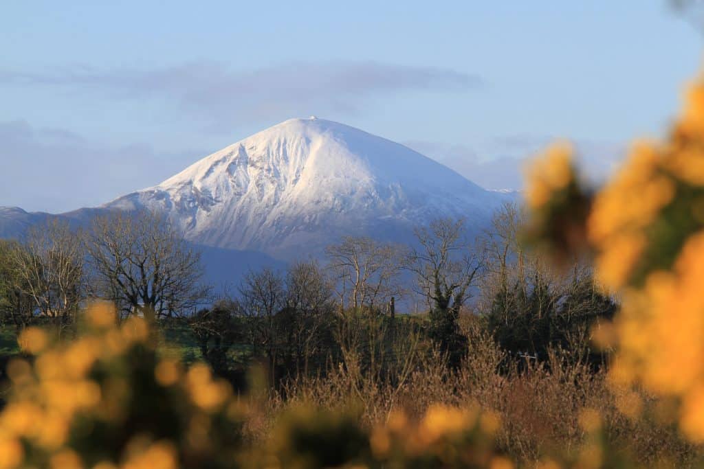
Croagh Patrick, Co. Mayo. Photo: Richard Creagh
Croagh Patrick in Co. Mayo is Ireland’s holy mountain, 764m (2,507ft) above Clew Bay. Locals call it “the Reek”. Tradition says St Patrick fasted on the summit for 40 days, and crowds climb it on Reek Sunday, the last Sunday in July.
The visitor centre, Teach na Miasa, is at the car park in Murrisk. It’s steep, so wear proper boots and bring layers, water and a charged phone.
Other good climbs near the route include Errigal in Donegal, Knocknarea in Sligo, Diamond Hill in Connemara and Brandon in Kerry. Turn back if the cloud comes down.
2. Stay on an island
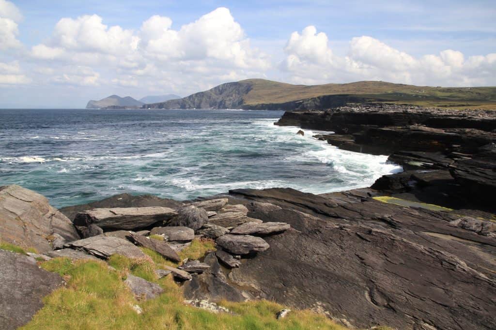
The view from Culloo Rock on Valentia Island, Co. Kerry. Photo: Richard Creagh
A day trip to an island is good. A night on one is better, because once the day visitors leave, the place goes quiet.
Achill and Valentia (in the photo) are the easy ones, joined to the mainland by bridges. Aran Island Ferries sail to the Aran Islands year-round from Rossaveel in Connemara, and boats from Doolin run in season. Further south, the Great Blasket and Dursey are wilder and quieter. Check every operator before you travel.
3. Find a trad session in a pub
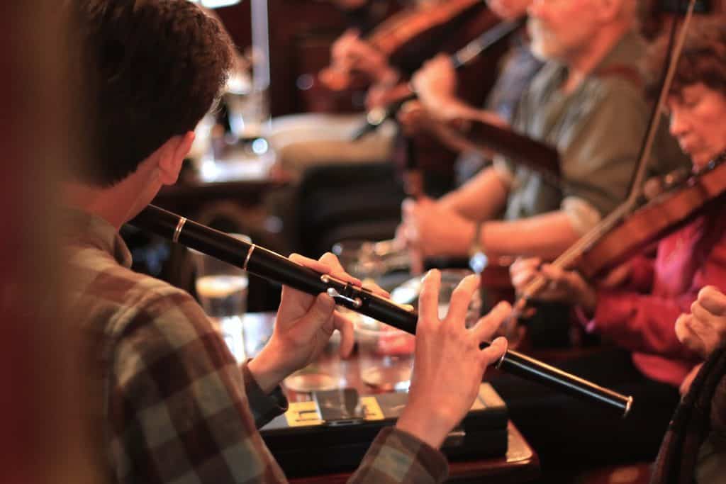
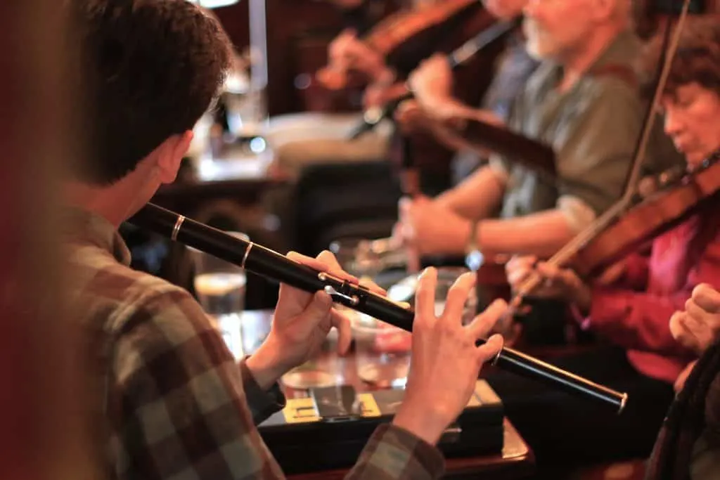
A session in Miltown Malbay, Co. Clare, during Willie Clancy Week. Photo: Richard Creagh
A trad session is an informal gathering of musicians playing traditional Irish tunes, usually in a pub. There’s no stage and no set list: they sit around a table and play for each other. It’s a big part of the craic (say “crack”), our word for fun and good company.
Ask at the bar about session nights. Keep the chat down during a slow tune, and don’t sit at the musicians’ table unless you’re asked.
The photo was taken in Miltown Malbay, Co. Clare, during Willie Clancy Week. The Willie Clancy Summer School of traditional music is held there every July, and the 2027 school is listed for 3 to 11 July. For more, see my list of Ireland’s most legendary pubs.
4. Take a coastal walk
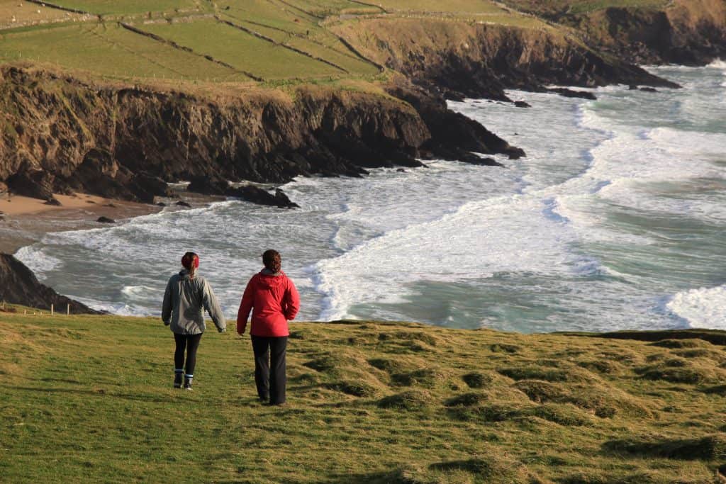
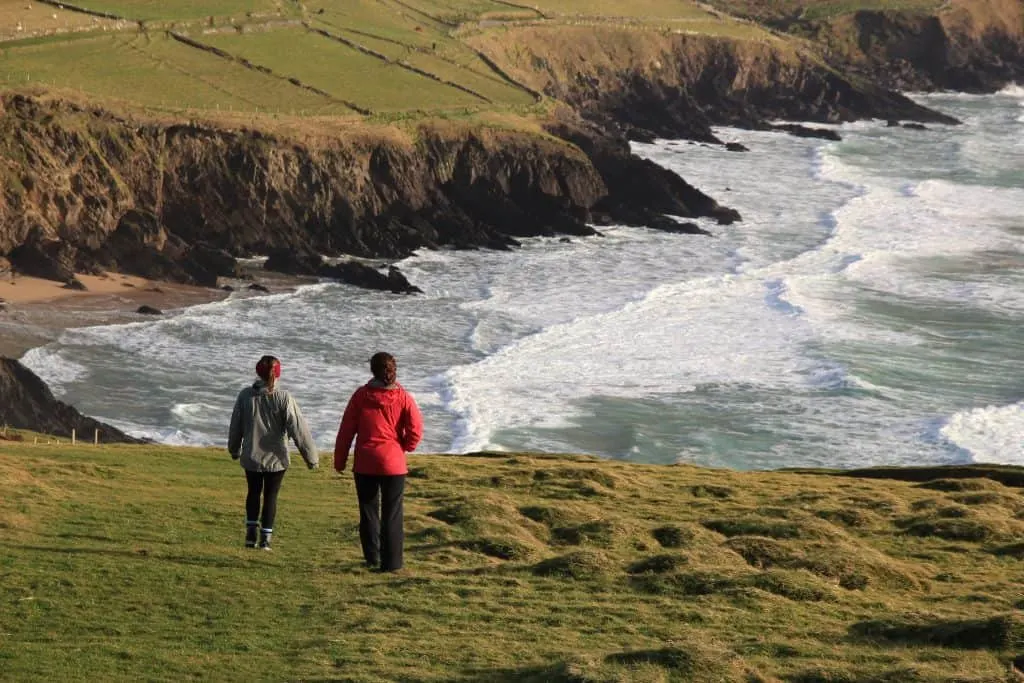
Dunmore Head on the Dingle Peninsula, Co. Kerry. Photo: Richard Creagh
This is Dunmore Head, the end of mainland Ireland, with nothing but the Atlantic beyond. Take it in from the public roads and viewpoints.
Good public walks include the Cliff Path at Sliabh Liag, the harbour walk at Killary and the Burren National Park trails. Leave gates as you find them, keep dogs on a lead near livestock and stay well back from cliff edges.
5. Get in the water
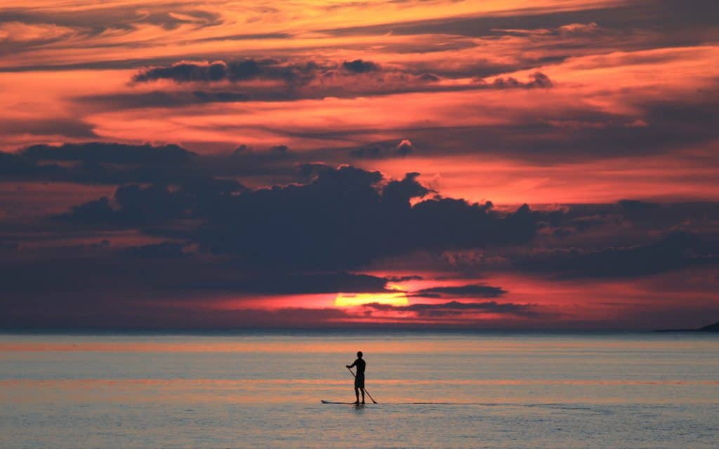
Paddleboarding on Carrownisky Strand, Co. Mayo. Photo: Richard Creagh
You’ve driven beside the Atlantic for days, so get in it. A strand is our word for a beach, and Carrownisky Strand near Louisburgh is one of Mayo’s Discovery Points. Surfing, paddleboarding and kayaking are on offer all along the coast.
If you’re new to it, go with a qualified surf school or tour operator. Check conditions and tides, and never swim alone. The water is bracing even in summer, so wear a wetsuit.
Wild Atlantic Way FAQ
How long is the Wild Atlantic Way?
The official length is 2,500km, about 1,550 miles. That’s nearly five times the 520km (323 miles) of the fastest inland roads between the two ends.
Where does the Wild Atlantic Way start and end?
Officially it runs from the Inishowen Peninsula in Co. Donegal to Kinsale in Co. Cork. Many guides start it at Malin Head. It’s signed in both directions, so you can start at either end.
How long does it take to drive the Wild Atlantic Way?
Pure driving is roughly 50 to 60 hours, by my estimate. Allow two weeks for the whole route, or three to take it slowly. Ten days covers the highlights.
Can you do the Wild Atlantic Way in 7 days?
Not all of it, unless you enjoy living in the car. A week is plenty for one half, though. My 7-day plan above runs from Galway to Kinsale.
Which direction should you drive the Wild Atlantic Way?
Either works, because the route is signed northbound (N) and southbound (S). Pick the direction that suits your flights. On the Slea Head Drive, though, the local tourism body asks visitors to go one-way, clockwise.
When is the best time to drive the Wild Atlantic Way?
May, June and September, with long days and fewer crowds. Met Éireann says May and June are the sunniest months. Many attractions cut their hours from October to March.
Is the Wild Atlantic Way hard to drive in a car or campervan?
The main roads are fine, but many scenic stretches are narrow and winding, so take it slowly and use the passing places. Campervans can manage most of the route, but not the Conor Pass, which is closed to campervans, caravans and coaches.
Further reading and photo credits
For a guidebook in the glovebox, try Exploring Ireland’s Wild Atlantic Way by David Flanagan and Richard Creagh. Richard took the photos in this guide. It’s published by Three Rock Books. The third edition, from December 2024, has 272 pages, 24 maps and about 300 photos, and includes the Shannon Estuary Way.
Photos: Richard Creagh, richardcreagh.com
More Irish travel reading
- 5 greatest Irish road trips to do in your lifetime
- The video that will make you want an Irish road trip
- 10 most beautiful places to visit in Ireland
- Fairytale Irish castles to visit
- An Irish honeymoon video on the Wild Atlantic Way
- Lough Tay, the Guinness Lake in Wicklow
- The American who travelled from Cork to Donegal by horse
- St Brendan the Navigator, the Kerry monk of the Atlantic
- Croagh Patrick: Ireland’s Holy Mountain, Where Pilgrims Still Climb Barefoot
Love this? Save it to your Pinterest board for later.
A little bit of Ireland in your inbox every Friday ☘️
The free Weekly Dose of Irish: an Irish joke, a Celtic symbol, an Irish fact, a poem and the week’s best articles in one short email. Join 9,600+ readers.
Free. One short email every Friday. Unsubscribe any time.