The Giant’s Causeway, Clochán an Aifir in Irish, is a pavement of about 40,000 basalt columns on the north coast of Co. Antrim, Northern Ireland. It formed about 60 million years ago, when a deep pool of lava cooled slowly and cracked into columns. Legend says the giant Fionn mac Cumhaill (Finn McCool) built it as a road to Scotland. It has been a UNESCO World Heritage Site since 1986 and is cared for by the National Trust. Walking down to the stones is free; parking and the visitor centre are not.
Picture a staircase of dark stone stepping down from the cliffs into the sea. Most of the steps are six-sided, fitted together so neatly that some people once took them for human work.
Locals had a better explanation: a giant built it. In the best-known version, he ends up disguised as a baby to escape his rival.
I’ve told how young Fionn mac Cumhaill won his wisdom in The Salmon of Knowledge. Here’s his most famous landmark: the volcanic story, the legend, the Irish name and how to visit.
Jump to:
- What is the Giant’s Causeway?
- How the Giant’s Causeway formed
- The legend of Finn McCool and Benandonner
- The Irish name: Clochán an Aifir
- How the Giant’s Causeway became famous
- The Wishing Chair, the Giant’s Boot and other features
- Visiting the Giant’s Causeway
- Along the Causeway Coastal Route
- Giant’s Causeway FAQ
- More Irish heritage reading
What is the Giant’s Causeway?
The Giant’s Causeway is a natural pavement of basalt columns at the foot of the cliffs on the north Antrim coast, about 3 km (2 miles) from the village of Bushmills. UNESCO counts some 40,000 columns, and it made the Giant’s Causeway and Causeway Coast a World Heritage Site in 1986.
It’s really three outcrops, the Grand, Middle and Little Causeways, between the bays of Port Ganny and Port Noffer.
The National Trust has owned most of it since 1961. Before the pandemic it drew more than a million visitors a year, says the British Geological Survey, and UNESCO calls it Northern Ireland’s most popular tourist attraction.
How the Giant’s Causeway formed
About 60 million years ago, at the start of the Palaeogene period, the ancient continent of Laurasia was splitting apart and the North Atlantic was beginning to open. Lava poured from volcanoes and fissures and buried the landscape, explains the British Geological Survey.
Then came a long lull, when the lava weathered into a red, iron-rich layer and forests grew over it. When eruptions resumed, fresh lava drained into the valleys, and at the Causeway it pooled into a lava lake about 90 metres deep. It cooled slowly and evenly, cracking into thousands of columns. Much later, Ice Age glaciers scraped off the rock above, and the sea exposed the columns.
Why are the columns hexagonal?
Think of mud drying into polygons. Cooling lava does the same: its surface shrinks faster than the hot rock below, the strain opens cracks, and the cracks grow downwards into columns.
Why six sides? In 2015, physicists led by Martin Hofmann at the Dresden University of Technology worked out which crack patterns release the most energy. At first it’s cracks meeting at right angles. But once the cracks push down into the rock together, junctions of three cracks at 120 degrees win out. That’s the angle at each corner of a hexagon, so the pattern drifts towards hexagons as it deepens.
Not every column is a hexagon. Most have five, six or seven sides, with a few of four or eight, says the World Heritage Site management plan. Many are stacks of segments 30 to 60 cm thick, linked by ball-and-socket joints, which is why some tops are hollowed or domed.
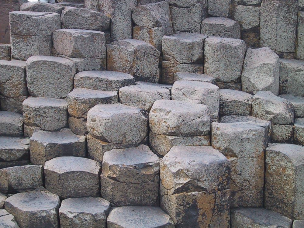
Close-up of the columns at the Giant’s Causeway. Photo: David Singleton, CC BY 2.0, via Wikimedia Commons
The legend of Finn McCool and Benandonner
This is folklore, told many ways. Here’s the version told at the Causeway today, in my own words.
Fionn mac Cumhaill (FIN muh-KOOL), Finn McCool in English, was a giant on the Antrim coast. His rival, the giant Benandonner, lived across the water in Scotland. To settle things with a fight, Finn built a road of stone across the sea.
Then he got a proper look at Benandonner, who was far bigger than he’d bargained for. Finn fled for home, losing a boot on the way.
His wife, Oonagh, kept a cool head. She covered Finn with a blanket as if he were asleep. When Benandonner came pounding across the causeway and banged on the door, she said Finn was out. The sleeping figure? That was their son, Oisín (OSH-een; in Munster, uh-SHEEN).
Benandonner looked at the enormous baby and did the sums. If the child was that size, how big was the father? He fled home, ripping up the causeway behind him so Finn could never follow. Only the two ends survived: the Giant’s Causeway in Antrim and Fingal’s Cave on Staffa, in Scotland.
The geology really does link them: Staffa’s columns formed in the same volcanic episodes, says the British Geological Survey. The cave’s English name comes from Fingal, Fionn’s name in James Macpherson’s “Ossian” poems.
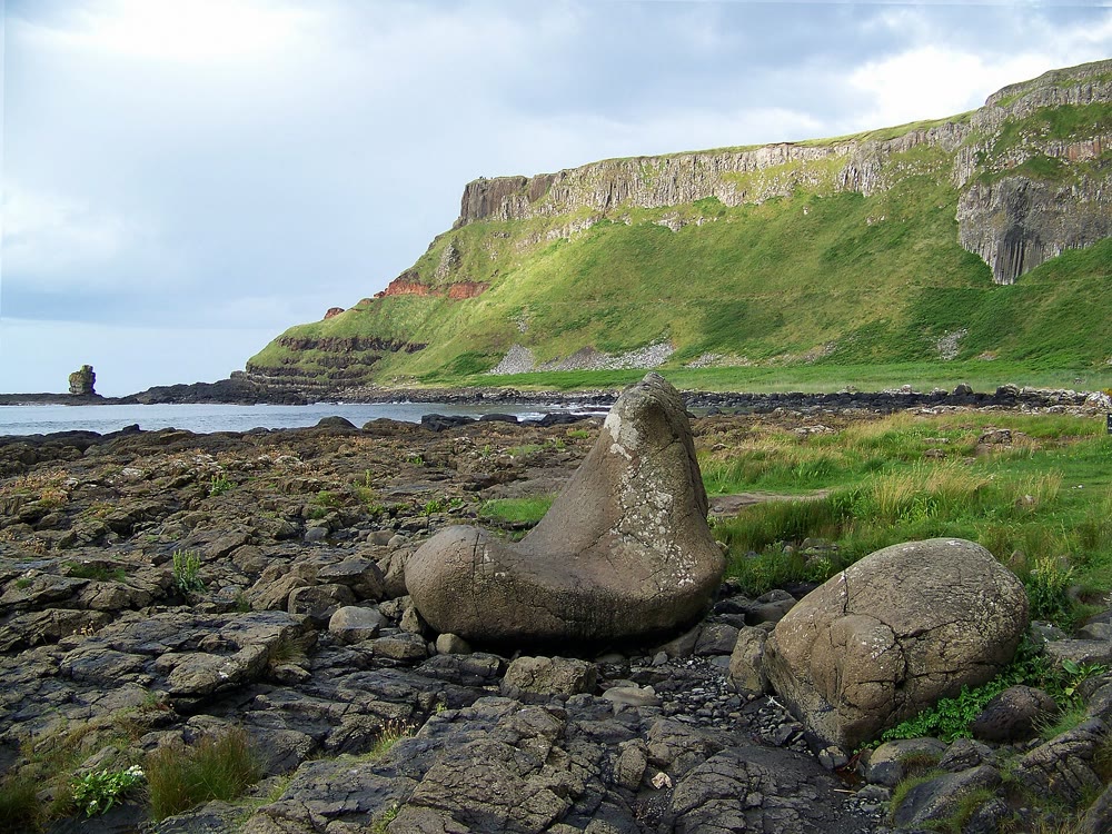
The Giant’s Boot at Port Noffer, Giant’s Causeway. Photo: Einaz80, CC BY-SA 4.0, via Wikimedia Commons
Where the versions differ
- A different rival: the baby trick also turns up in William Carleton’s comic tale “A Legend of Knockmany” (1845). Fin, busy building the Causeway, hears that a fearsome giant is after him and hurries home to Knockmany Hill in Co. Tyrone. The rival is Cucullin, whose name echoes Cú Chulainn (koo KHUL-in); the narrator can’t even say whether he’s Irish or Scottish.
- Built for love: the National Trust also tells a version that Causeway guides told in the 18th and early 19th centuries, preserved in an 1830 poem by a “Mary Anne” that Eva Hov found in a Norwegian library. Finn is building a way across to a woman in Scotland, and his grandmother, afraid of losing him, sends storm after storm to wreck it. He gets across but dies of exhaustion, and his grandmother, seeing what her magic has done, turns to stone.
- The giant himself: in the medieval tales, Fionn is a warrior-poet who leads the Fianna, not a giant. The giant came much later.
The Irish name: Clochán an Aifir
In Irish, the Giant’s Causeway is Clochán an Aifir (roughly KLOKH-awn un AF-ir; in Munster Irish the stress moves to the second syllable, kluh-KHAWN). That’s the form in Foras na Gaeilge’s English-Irish dictionary and the Placenames Database of Ireland.
Clochán is the easy part: the placenames database translates it as stepping-stones or causeway. Aifir is the puzzle. You’ll often see it translated as “the giant”, but there’s no agreed meaning. In Ó Dónaill’s dictionary, aifir is a verb meaning to rebuke or punish, and aifear is a noun from the same root. Neither fits a causeway.
It may be a worn-down form of an older name. The placename scholar Patrick McKay, in his Dictionary of Ulster Place-Names (2007), gives the original Irish name as Clochán na bhFomhórach (roughly KLOKH-awn nuh WOH-wor-ukh), the causeway of the Fomorians, and suggests Clochán an Aifir may be a corruption of it. A version of that older name was written down around 1675.
The Fomhóraigh (FOH-war-ee), or Fomorians, were the monstrous enemies of the gods in medieval Irish legend; their best-known king is Balor of the Evil Eye, who features in my Celtic gods guide. Fittingly, Ó Dónaill gives fomhórach three meanings: Fomorian, pirate and giant. So “Giant’s Causeway” may be a loose translation of the old Irish name, as McKay suggests.
McKay records one more old name, Tóchar na dTréanfhear (roughly TOH-khur nuh DRAYN-ar), the causeway of the strong men or champions. And the giant lingers on the shore: the bay where the Giant’s Boot sits is Port Noffer, which locals call “the bay of the giant”, says the National Trust.
How the Giant’s Causeway became famous
Shepherds and kelp gatherers had always known the Causeway; the wider world heard of it through the Royal Society in London. In 1692 a Cambridge scholar visited with William King, Bishop of Derry, and Sir Richard Bulkeley, who had never been there, passed on his account in a letter of 24 April 1693, printed in the Society’s Philosophical Transactions. It’s the first recorded description, says the Royal Society.
A fuller account by the clergyman Samuel Foley followed in 1694, with the first printed picture of the Causeway. The Irish physician Thomas Molyneux added notes arguing that the Causeway was natural: people had been misled by its name, he wrote, because locals blamed anything strange on “Giants, Fairies, Daemons, and such like Imaginary Causes”.
The pictures that made it truly famous came from a Dublin artist, Susanna Drury. In 1739 she lived near the Causeway for three months and painted it day after day, says the UK Government Art Collection. The next year her pair of views won the Dublin Society’s £25 premium, and engravings of them by François Vivares, made in the 1740s, circulated all over Europe.
The prints also fed a scientific argument. The French Encyclopédie copied her East Prospect in a 1768 volume of plates, and the captions, by the geologist Nicolas Desmarest, were the first in print to suggest that basalt columns like these were volcanic, says the Linda Hall Library. In 1786 the Rev. William Hamilton backed the volcanic idea in his study of the Antrim coast; Hamilton’s Seat, east of the Causeway, is named after him.
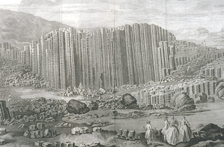
Susanna Drury’s East Prospect of the Giant’s Causeway, as copied for the plates of the French Encyclopédie, 1768. Public domain, via Wikimedia Commons
Tourists followed. In 1883 the world’s first hydroelectric tramway opened between Portrush and Bushmills, reaching the Causeway in 1887; it closed in 1949. In 1896 the stones were fenced off, with admission charged at a turnstile, and the barriers stayed until the National Trust took over in 1961. Visitors once carried off stones as souvenirs, says UNESCO, but that stopped long ago.
The Wishing Chair, the Giant’s Boot and other features
Look out for these formations, named by local guides:
- The Wishing Chair: a natural seat formed by the columns. A 1935 British Pathé film, now on the IFI Archive Player, promised good fortune to anyone who sat in it or drank from the Wishing Well.
- The Giant’s Boot: a big rounded boulder at Port Noffer that really does look like a boot. The National Trust says it’s the one Finn lost.
- The Organ: a row of long, straight columns in the cliffs beyond Port Noffer, like a church organ’s pipes.
- Granny: a rock on the Stookans headland, west of Port Ganny, shaped like a bent old woman. The National Trust says she’s Finn’s grandmother from the love story, turned to stone.
- The Chimney Tops: tall, isolated basalt stacks at Port na Spaniagh. The bay is named after the Spanish Armada galleass Girona, wrecked below them in October 1588 with about 1,300 men aboard. Only five survived, or nine by some accounts.
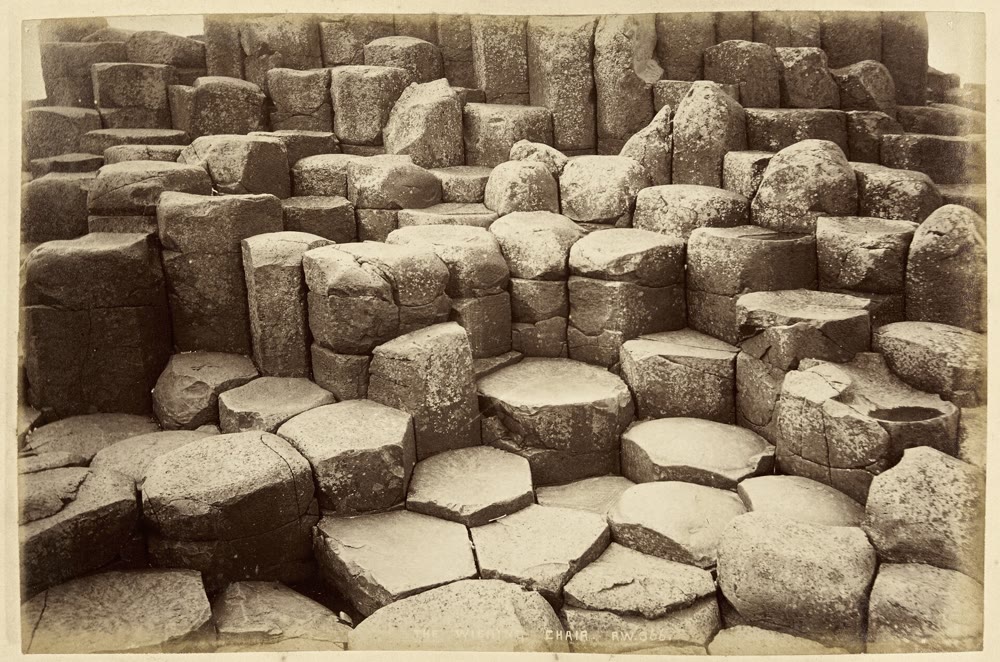
The Wishing Chair, Giant’s Causeway, photographed by Robert Welch about 1888. Public Record Office of Northern Ireland, no known copyright restrictions, via Wikimedia Commons
Visiting the Giant’s Causeway
These details were checked in October 2026, but prices, times and parking rules change, so check the National Trust before you go.
- Is it free? Walking down to the stones costs nothing: the road is a public right of way. You pay for the facilities, including the main car park, through a Visitor Experience ticket.
- The Visitor Experience: covers parking, the exhibition, audio guides and hourly guided tours. Online prices started at £16 for adults and £8 for children (under 5s free) in October 2026. National Trust members get in free, and booking ahead is strongly recommended.
- Opening hours: from 1 September to 25 October 2026 the visitor centre opens 9am to 5pm (last admission 4pm); summer hours are longer. The coastline is open from dawn to dusk all year.
- Walkers’ parking: the Causeway Coast Way car park (Innisfree Farm, 60 Causeway Road) cost £12 a vehicle through the JustPark app in October 2026. It’s open 5am to 8pm, with no overnight parking.
- Reaching the stones: the Blue trail follows the road down past the Grand Causeway to the Giant’s Boot, about 1.3 km (0.8 miles) or 25 minutes’ walk. The Red trail takes the clifftop and comes down the steep Shepherd’s Steps. An accessible Translink shuttle bus runs down the road for a small extra charge.
Getting there and when to go
The Causeway is about 60 miles (97 km) north of Belfast, an easy day trip; see my Belfast guide, which also covers the UK entry rules. Translink buses stop nearby, and showing a valid public transport ticket gets you a discounted “Green Ticket”. A Park and Ride runs from Dundarave car park in Bushmills.
The Causeway is busiest from May to September; before the pandemic, a peak day brought more than 5,000 visitors, says the management plan, so come early or late. Wear grippy shoes, since the columns are uneven and slippery when wet, and keep well back from the waves. And don’t push coins into the cracks: the National Trust says they rust, swell and make the rock flake.
Along the Causeway Coastal Route
The Causeway Coastal Route follows the coast roads between Belfast and Derry~Londonderry by way of Ballycastle, and it’s on my list of the greatest Irish road trips. Three famous stops are nearby.
Dunluce Castle
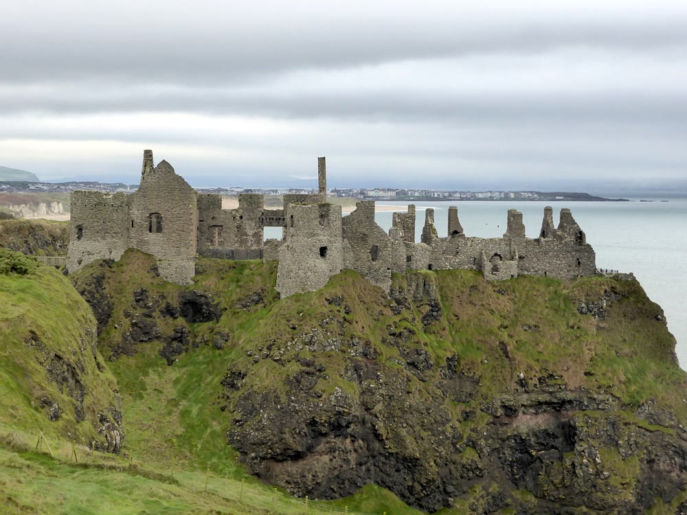
A few miles west, the ruins of Dunluce Castle crown a sheer rock above the sea. The MacQuillan family built it around 1500, and it’s first mentioned in writing in 1513, says the Department for Communities. The MacDonnells seized it in the 1550s, and legend adds a banshee and a tale that, on a stormy night in 1639, the kitchens collapsed into the waves. It’s one of my famous Irish castles.
Carrick-a-Rede Rope Bridge
Near Ballintoy, farther east, a rope bridge hangs almost 30 metres above the sea, across a 20-metre gap to the island of Carrick-a-Rede. Salmon fishermen have strung a bridge here for over 200 years, traditionally renewing it each year to fish from the island. Book ahead; it closes in high winds.
The Dark Hedges
Inland on the Bregagh Road, an avenue of beech trees planted by the Stuart family of Gracehill House, built around 1775, meets overhead. Game of Thrones used it as the Kingsroad. The road has been closed to traffic, apart from farm vehicles, since 2017, and 13 of the ageing trees have gone since November 2023, says the Causeway Coast and Glens Heritage Trust. Don’t walk under them in or just after a storm.
Giant’s Causeway FAQ
Is the Giant’s Causeway free to visit?
Yes, on foot. You pay for the main car park and visitor centre through the Visitor Experience ticket; National Trust members get in free.
Why are the Giant’s Causeway stones hexagonal?
Cooling lava shrinks and cracks. As the cracks grow down into the rock, junctions of three cracks at 120 degrees release more energy than right-angled ones, pushing the pattern towards six-sided columns.
Is the Giant’s Causeway in Ireland or the UK?
Both, in a sense. It’s on the island of Ireland, in Co. Antrim, Northern Ireland, which is part of the United Kingdom.
What is the Giant’s Causeway called in Irish?
Clochán an Aifir (roughly KLOKH-awn un AF-ir). An older name, Clochán na bhFomhórach, means the causeway of the Fomorians.
Love this? Save it to your Pinterest board for later.
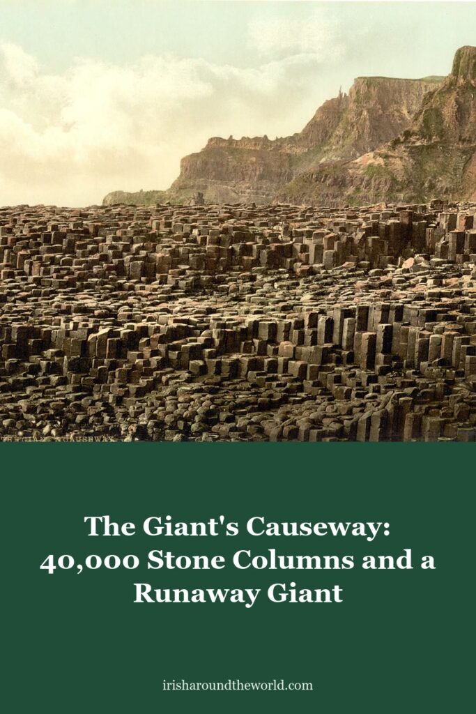
Pin image: Giant’s Causeway photochrom, Detroit Publishing Co., 1890 to 1900, Library of Congress. Public domain, via Wikimedia Commons.
A little bit of Ireland in your inbox every Friday ☘️
The free Weekly Dose of Irish: an Irish joke, a Celtic symbol, an Irish fact, a poem and the week’s best articles in one short email. Join 9,600+ readers.
Free. One short email every Friday. Unsubscribe any time.
More Irish heritage reading
- The Salmon of Knowledge: How One Burnt Thumb Made Fionn mac Cumhaill a Legend
- Cú Chulainn: The Teenage Warrior Who Held Off an Entire Army Alone
- Celtic Gods and Goddesses: 15 Irish Deities and Their Stories
- 11 Famous Irish Castles: Their History, Legends and How to Visit
- Things to Do in Belfast: 10 Best Sights and Day Trips (2026)
- The Táin: How a Royal Bedtime Row Over a Bull Started Ireland’s Greatest Epic
Featured image: The Giant’s Causeway, Co. Antrim, a photochrom print published by the Detroit Publishing Co. between 1890 and 1900. Library of Congress. Public domain, via Wikimedia Commons.