
The Cliffs of Moher, Aillte an Mhothair in Irish, run for about 14 km (8 miles) along the Atlantic coast of Co. Clare and reach 214 metres (702 feet) at their highest point. The visitor centre near Liscannor opens every day except 24 to 26 December. As checked on 15 October 2026, a 2026 adult gate ticket costs €15, online tickets are cheaper, and parking is included. The coastal walk between Doolin and Hag’s Head is mostly closed on safety grounds, but you can still walk out of Doolin as far as Surfers Path for free. Puffins nest here from late March to mid-July.
Stand beside O’Brien’s Tower on a clear evening and the ground simply stops. About 200 metres below, the Atlantic works away at layers of rock that formed when this corner of Ireland lay near the equator.
Almost 1.5 million people visited the Cliffs of Moher in 2024, RTÉ reported. Older guides may mislead you, because the much-loved cliff-top trail has been largely closed since August 2024.
Here’s what’s open, what it costs, when to see puffins and why winter works, plus the old stories, from a hag on the headland to a city under the bay.
Jump to:
- What and where are the Cliffs of Moher?
- Getting there from Dublin, Galway and Shannon
- Tickets, opening hours and parking
- The coastal walk from Doolin: what’s open now
- O’Brien’s Tower (1835)
- How the cliffs were made
- Puffin season
- Legends of the cliffs
- Cliffs on screen
- Staying safe
- The best time to visit
- Visiting in winter
- Cliffs of Moher FAQ
- More Irish travel and heritage reading
What and where are the Cliffs of Moher?
The cliffs face the Atlantic between Doolin in the north and Hag’s Head in the south, beside the village of Liscannor in north Clare. The visitor centre gives their length as almost 14 km and their height as 214 metres just north of O’Brien’s Tower; the National Parks and Wildlife Service (NPWS) says 203 metres.
They lie within the Burren and Cliffs of Moher UNESCO Global Geopark, and the cliffs are a Special Protection Area for seabirds. Clare County Council owns the visitor centre, which opened in 2007 and is tucked into the hillside so it barely shows from the cliffs.
What does Moher mean?
In Irish the cliffs are Aillte an Mhothair (roughly AL-chuh un WUH-hir; in Clare’s Munster Irish the mh sounds more like a v). Aill means a cliff.
The 19th-century place-name scholar P. W. Joyce explained mothar as the ruin of an old fort, and said the cliffs were named after one near Hag’s Head, Moher O’Ruan. Logainm.ie, the state’s placenames database, also glosses An Mothar as “the ruin”, though Ó Dónaill’s modern dictionary has no such sense, giving mothar as a thicket, a large mass or a dark cloud.
The visitor centre says the fort was pulled down in 1808 for stone to build the signal tower that still stands on Hag’s Head. In English, locals sound the h: roughly MOH-her, not “more”, and it’s spelled Moher, not Mohr. My guide to Irish place names explains how names like this were anglicised.
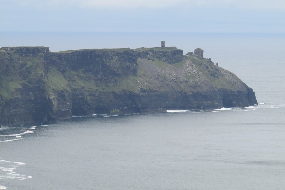
Hag’s Head, the southern end of the cliffs, with its Napoleonic-era signal tower, seen from O’Brien’s Tower. Photo: Chris Light, CC BY-SA 4.0, via Wikimedia Commons
Getting there from Dublin, Galway and Shannon
The visitor centre sits on the R478 between Liscannor and Doolin. Its own driving estimates:
- From Galway: about 1 hour 36 minutes via the M18 motorway, or 1 hour 45 minutes on the scenic route through Kinvara and Ballyvaughan.
- From Dublin: about 4 hours via Limerick, a very long day trip.
- From Shannon Airport: about an hour.
- From Kerry: take the 20-minute Tarbert to Killimer car ferry; the cliffs are about 45 minutes beyond it.
No car? Bus Éireann route 350 runs between Galway and Ennis via the cliffs; check its timetable. Both towns have trains from Dublin Heuston, though for Ennis you usually change at Limerick Junction. In summer, the free Burren and Cliffs Explorer shuttle links Doolin, Lahinch and other villages with the cliffs (in 2026, from 21 May to 20 September).
Doolin Ferry Company also runs seasonal cliff cruises from Doolin Pier, past the great sea stack and the Harry Potter cave, weather permitting. The cliffs are a headline stop in my Wild Atlantic Way route guide, and Galway makes a lively base (see things to do in Galway).
Tickets, opening hours and parking
These details are as checked on the official Cliffs of Moher admission page on 15 October 2026. Prices and times change, so check before you go.
- Hours: 9am to 5pm from November to February; 8am to 7pm in March, April, September and October; 8am to 9pm from May to August. Closed 24, 25 and 26 December.
- 2026 gate prices: adult €15, student or senior (over 65) €12, family €30 (two adults, two children under 12).
- Online: cheaper, and priced by time slot. Online, the official booking page lists adult tickets from €8, the off-peak price (before 11am or after 4pm); peak slots from 11am to 4pm cost more.
- Children: under-12s go free with a parent or guardian, up to four per adult.
- 2027: online adult tickets €14 at peak and €9 off peak, €7 from 6pm to 9pm in May to August, and €16 at the gate.
Your ticket covers the exhibition, the Ledge 4D cliff-face show, O’Brien’s Tower and its rooftop, the paved paths, binoculars on loan, the Lifts of Moher buggy for visitors with limited mobility, and parking. Parking is opposite the visitor centre: drive to the admission pod with your booking, ideally within 15 minutes of your slot. There are no electric-car chargers on site.
Allow about two hours. Once you’re in, you can stay until closing, and the car park barrier lifts automatically after hours, so you can linger for sunset.
The coastal walk from Doolin: what’s open now
For years the best free way to see the cliffs was the Cliffs of Moher Coastal Walk, a cliff-edge path across farmland from Doolin to Liscannor via the visitor centre and Hag’s Head. Fáilte Ireland lists it as 19.5 km, about four and a half hours, and strenuous.
It isn’t open end to end. Two visitors died in separate falls from the trail in 2024, and that August, after a Sport Ireland safety audit found 39 significant problems, large parts of it closed, The Irish Times reported. It’s a grade 5 route, on a par with Carrauntoohil, Ireland’s highest mountain, RTÉ noted.
The trail crosses land owned by some 36 farmers, who in April 2026 agreed in principle to let Clare County Council manage it, Agriland reported. Works on this protected site can only happen in winter, outside the nesting season.
Here’s what the official coastal walk page said on 15 October 2026 (status dated 1 August 2026):
- From Doolin: open only as far as Surfers Path, where you turn back. There’s no access to the visitor centre this way, and the road there is hazardous, so don’t walk along it.
- From Liscannor and Hag’s Head: the 6 km southern section is fully closed.
- Inside the visitor centre site: about 3.5 km of safe walking, 1 km north past O’Brien’s Tower and back on a path resurfaced in 2025, plus a 1.5 km round trip to the southern viewing platform.
The Doolin stretch is free but exposed, so wear boots and respect every fence. People climbing barriers into closed sections has been a real problem, the trail’s managers told The Irish Times in 2025.
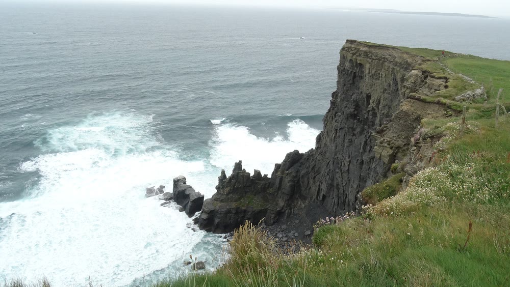
The headland at Aill na Searrach, the cliff of the foals, on the northern stretch of the cliffs. Photo: Colin Park, CC BY-SA 2.0, via Wikimedia Commons (Geograph)
O’Brien’s Tower (1835)
Cornelius O’Brien (1782 to 1857), the local landlord and MP for Clare for most of the years from 1832 to 1857, built this round stone tower in 1835 as a viewing point for visitors, the visitor centre says. Local stories say it began as a teahouse, or that he wanted to charm the women he courted.
He also laid paths and a wall of Liscannor flagstone, and set a stone table at the cliff edge. In 1854 a visitor writing in the Clare Journal praised his improvements, right down to a piper laid on to entertain guests. The O’Briens take their name from Brian Boru, and the visitor centre calls Cornelius a descendant of the high king.
By the 1960s the tower was a ruin. When a German industrialist made an offer for the land, Clare County Council stepped in and bought just over two acres around it for £1,060. The tower reopened in 1974, and since 2022 a Clare whiskey bonder, JJ Corry, has matured barrels inside it.
When the air is clear, the rooftop looks across Galway Bay to the Aran Islands, home of the Aran sweater, and the Twelve Bens mountains in Connemara.
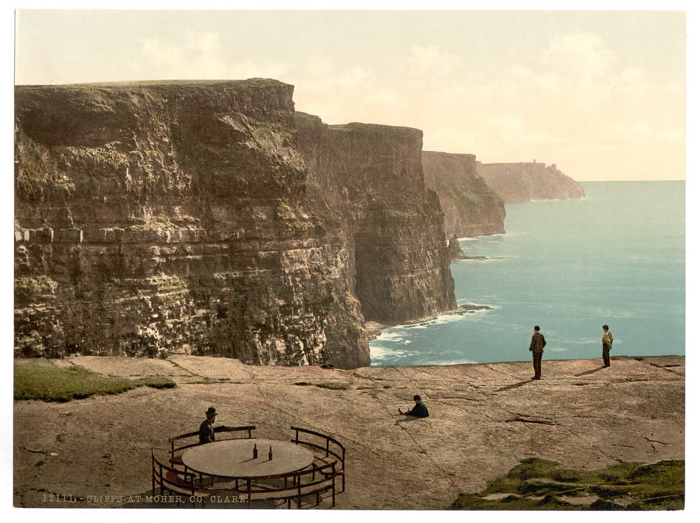
Victorian visitors on the flagstone cliff top at Moher, with a round table and iron seats in the foreground, looking south along the cliffs. Photochrom print no. 12111, Detroit Publishing Co., between 1890 and 1900. Library of Congress. Public domain, via Wikimedia Commons
How the cliffs were made
Look at the cliff face and you’ll see stripes: pale sandstone ledges between thicker bands of darker siltstone and shale. Rivers carried that mud and sand into a shallow sea about 320 million years ago, building a delta like the Mississippi’s, when this rock lay near the equator, the visitor centre explains.
The soft shale wears away, leaving sandstone ledges hanging until they snap off, and old vertical cracks give the cliffs their sheer faces. Rockfalls are normal here, which is exactly why the paths are fenced.
A 2005 Geological Survey Ireland audit rates the coast from Doolin to Hag’s Head as internationally important. It highlights a fossil insect from the Doolin cliffs whose wings could fold back over its body, the earliest of its kind found in the British Isles.
Look down, too. The squiggles on the flagstones of the paths are trace fossils, burrows left by creatures in that ancient mud.
Below O’Brien’s Tower stands Branaunmore, An Branán Mór in Irish (roughly un BRAN-awn MORE), a sea stack 67 metres tall that erosion cut off from the cliff.
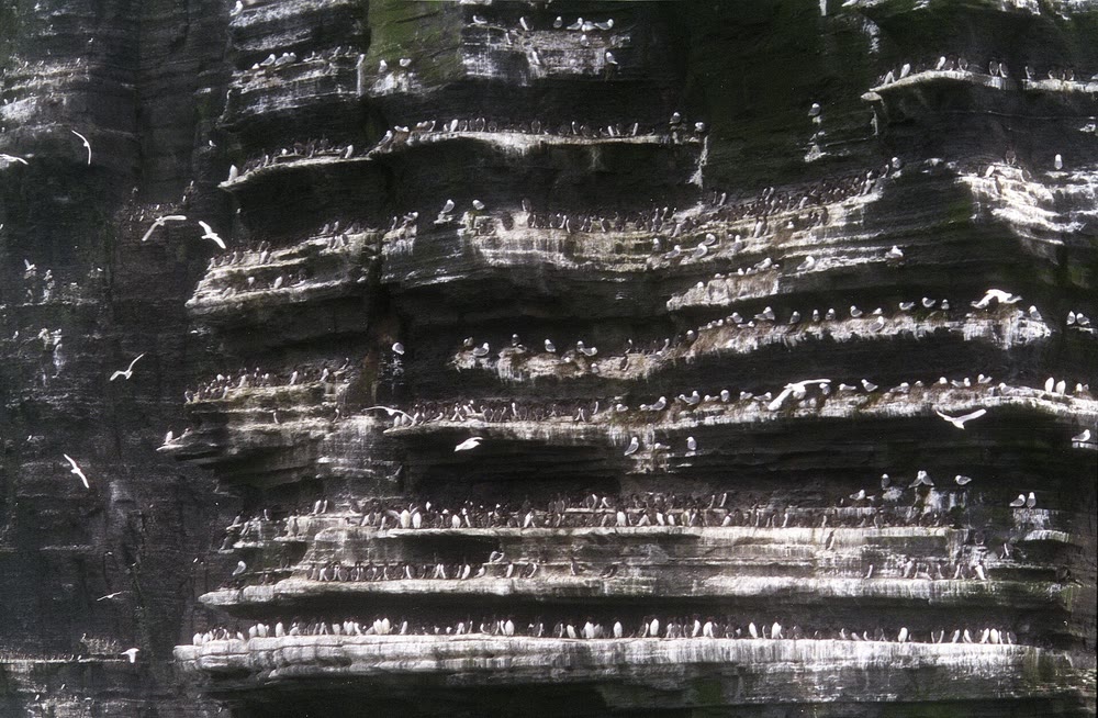
Seabirds crowd the layered ledges of Branaunmore (An Branán Mór), the great sea stack below O’Brien’s Tower. Photo: Jerzy Strzelecki, CC BY 3.0, via Wikimedia Commons
Puffin season
From late February the ledges begin to fill, and the visitor centre counts more than 30,000 seabird pairs breeding here in season. The NPWS says the site holds Ireland’s largest kittiwake and razorbill colonies; a 1998 to 1999 survey counted 1,365 pairs of puffins.
Puffins, puifín in Irish (PWIF-een, or pwih-FEEN in Munster), arrive around the end of March and leave by mid-July, and May and June are best. They nest in burrows in the grassy slopes. The visitor centre’s tip: head for the south platform, which looks across to Goat Island, where Cornelius O’Brien is said to have kept goats.
On Branaunmore, fulmars nest near the top, kittiwakes below them, then guillemots and razorbills. Peregrines and choughs breed here too. The chough is cág cosdearg in Irish (roughly kawg KUS-jar-ug), the red-legged jackdaw.
If you’ve read about the puffins of Skellig Michael, these are their Clare cousins. Don’t feed the birds, and leave the drone at home: the visitor centre says drones are banned in the nesting season, April to September.
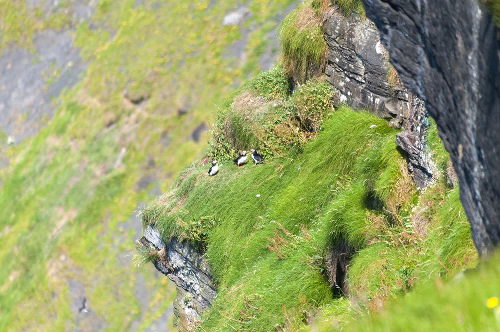
Puffins on a grassy ledge at the Cliffs of Moher in July 2014. Photo: Chris Gorringe, CC BY-SA 2.0, via Wikimedia Commons (Geograph)
Legends of the cliffs
The cliffs have gathered stories, and some are younger than they sound. For the bigger picture, start with my Irish mythology guide.
The cliff of the foals
Aill na Searrach (roughly al nuh SHAR-ukh) means the cliff of the foals. As the visitor centre tells it, when Christianity reached Ireland the old gods, the Tuatha Dé Danann, turned themselves into horses and hid in caves for centuries. When seven foals finally came out into the daylight, the sun startled them and they bolted over the edge. It’s a tale told in Christian times about the old gods fading, not evidence of pre-Christian belief. The reef below it, Ireland’s seabed mappers note, produces Aileens, a big wave famous among surfers.
The hag of Hag’s Head
Hag’s Head is Ceann Caillí in Irish (roughly kyan KAL-yee; in Munster, closer to kyown kal-YEE), from cailleach, a hag. In the visitor centre’s version, a witch called Mal fell for the warrior Cú Chulainn and chased him across Ireland. Where the Shannon meets the Atlantic, he leapt out to a sea rock and back; she followed, fell short and died, Malbay took her name, and her profile shows in the rocks of Hag’s Head. Loop Head there is Ceann Léime in Irish, from Léim Con Culainn, Cú Chulainn’s leap, says logainm.ie. More hags are in my guide to Irish witches.
A pupil at Barefield school near Ennis gave the Schools’ Collection another version in the late 1930s. A sleepless Corney O’Brien walked out to the headland one night, a fierce-looking hag hauled herself up the cliff out of the sea, and he ran home to Birchfield, Cornelius O’Brien’s real home. It has been Hag’s Head ever since, the pupil wrote.
The mermaid and the drowned city
In the Mermaid of Moher, a fisherman hides the cloak a mermaid needs to return to the sea. She marries him, but the day she finds it she goes back to the waves for good, the same kind of tale Irish storytellers told of seal women (see my selkie mythology guide).
Under Liscannor Bay, legend says, lies the sunken city of Kilstiffin, which will stay drowned until someone returns its lost golden key. Drowned forests and bogs really do lie in the bay, the visitor centre says, and in 2023 Geological Survey Ireland’s survey boats mapped Kilstiffin Reef.
Cliffs on screen
The visitor centre lists these films among those shot at the cliffs:
- Harry Potter and the Half-Blood Prince (2009): Harry and Dumbledore reach the Horcrux cave from the sea, and the real cave is visible looking south from the central platform. Watch the clip in my post on the Cliffs of Moher in Harry Potter.
- The Princess Bride (1987): the Cliffs of Insanity.
- Ryan’s Daughter (1970), with Robert Mitchum and Sarah Miles.
- The Mackintosh Man (1973), with Paul Newman and a car chase near the edge.
- Hear My Song (1991), with a drink at O’Brien’s Tower.
- Into the West (1992), where two boys chase their magical horse, Tír na nÓg, to the cliffs.
- Leap Year (2010), with Amy Adams.
Staying safe
- Stay on the paved paths and behind the walls. Edges overhang and rock falls without warning, so never climb a fence or barrier.
- Keep children close, and off the visitor centre’s grass roof.
- Bring a rain jacket, not an umbrella: the visitor centre says it’s usually too windy to use one.
- Check Met Éireann’s weather warnings. Under a Status Yellow wind warning, take extra care; under Orange, the cliff areas close and the site may be evacuated; under Red, it’s shut.
- Dogs are welcome on a lead outside, but only registered guide and support dogs can go indoors.
- If fog hides everything and you’re staying locally, you can reuse your ticket within 24 hours.
The best time to visit
To dodge the crowds, the visitor centre advises avoiding 11am to 4pm; early and late slots are also cheaper online. By season:
- April to June: puffins and long evenings. May and June are Ireland’s sunniest months, Met Éireann says, and April and May its driest.
- May to August: open until 9pm, with a cheaper late-evening online rate (6pm to 9pm) listed for 2027.
- September and October: open until 7pm; the puffins have gone, but fulmars stay all year.
Sunset is the magic hour. An 1876 Handbook to Lisdoonvarna and its Vicinity, quoted by the visitor centre, urged readers to “be persuaded to wait longer still” and see the cliffs by moonlight.
Visiting in winter (November to February)
Winter brings crashing seas, low golden light and short days.
- Hours: 9am to 5pm daily, closed 24 to 26 December. In 2027, winter peak pricing runs from 11am to 3pm.
- Daylight: around the winter solstice, the sun rises at about 8.45am and sets at about 4.20pm in nearby Ennis. Arrive by early afternoon for sunset.
- Rain: December is Ireland’s wettest month, says Met Éireann, and the west gets 1,000 to 1,400 mm a year. Pack waterproofs.
- Cold: frost is rare by the sea; most coastal areas get fewer than 10 frosty days a year.
- Wind: storms can bring warnings that close the site, so keep your plans flexible.
- Boats: Doolin’s cliff cruises are seasonal.
- Wildlife: puffins winter at sea, but fulmars, peregrines, choughs and ravens stay all year.
Pair a winter visit with a few festive days in Clare or Galway; my guide to Christmas in Ireland covers the markets and what’s open.
Cliffs of Moher FAQ
Can you walk from Doolin to the Cliffs of Moher?
Not at the moment. As checked on 15 October 2026, the path from Doolin is open only as far as Surfers Path, with no access to the visitor centre.
Is it free to visit the Cliffs of Moher?
Only the open stretch of trail from Doolin. The visitor centre site and O’Brien’s Tower need a ticket, which includes parking.
How much are Cliffs of Moher tickets?
In 2026 an adult gate ticket is €15 and a family ticket €30. Booking online is cheaper, especially outside 11am to 4pm.
How high are the Cliffs of Moher?
About 214 metres (702 feet) at the highest point, says the visitor centre; the NPWS gives 203 metres.
When is puffin season at the Cliffs of Moher?
From about the end of March to mid-July, best in May and June.
Which Harry Potter film was shot at the Cliffs of Moher?
Harry Potter and the Half-Blood Prince (2009): the sea cave where Harry and Dumbledore hunt for a Horcrux.
Love this? Save it to your Pinterest board for later.
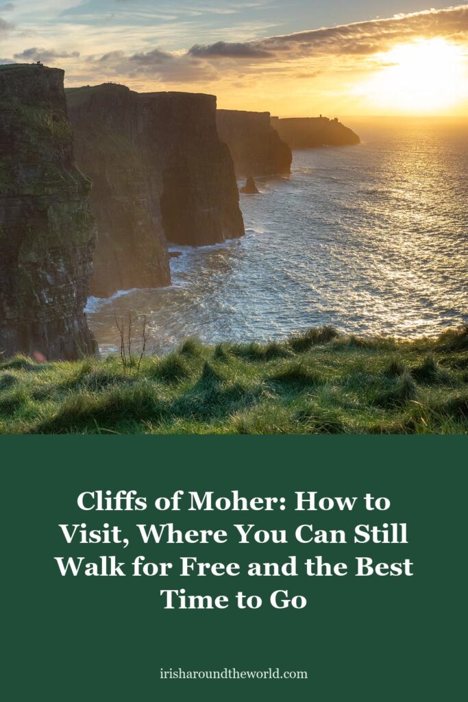
Pin image: Sunset over the Cliffs of Moher, looking south towards Hag’s Head, in November 2019. Photo: Ajay Suresh, CC BY 2.0, via Wikimedia Commons
A little bit of Ireland in your inbox every Friday ☘️
The free Weekly Dose of Irish: an Irish joke, a Celtic symbol, an Irish fact, a poem and the week’s best articles in one short email. Join 9,600+ readers.
Free. One short email every Friday. Unsubscribe any time.
More Irish travel and heritage reading
- Wild Atlantic Way Route: Map, Best Stops and 7, 10 and 14-Day Itineraries
- The Cliffs of Moher in Harry Potter: Watch the Half-Blood Prince Scene
- Skellig Michael: The Impossible Island Monastery, From Monks to Star Wars
- Selkie Mythology: The Seal People of Irish and Scottish Folklore
- The Aran Sweater: Its Real History, the Drowned Fisherman Myth and What the Stitches Mean
Featured image: Sunset over the Cliffs of Moher, looking south towards Hag’s Head, in November 2019. Photo: Ajay Suresh, CC BY 2.0, via Wikimedia Commons.